



![[Aggregator] Downloaded image for imported item #74865](https://jogjakini.com/wp-content/uploads/2026/10/i-nyoman-apraz_261001190742-428-1-148x111.jpg "[Aggregator] Downloaded image for imported item #74865")

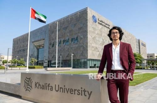
REPUBLIKA.CO.ID, I Nyoman Apraz Ramatryana (Lecture of Information Technology Faculty at UNU Jogja, currently undergoing postdoctoral studies as a researcher at Khalifa University, UAE)
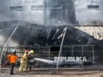
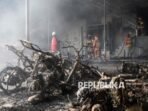
On 28 May 2023, fires burned 8,31 hectares across four locations in Palangka Raya, Central Kalimantan. Indonesia’s National Disaster Management Agency reported burning both above and below ground in the peat soil. The incident illustrates why forest and land fires, known locally as karhutla, require information about conditions that may be difficult to see.

Conceptual cutaway of a Kalimantan peatland fire. Smouldering pockets beneath the surface show why local conditions matter. This illustration does not reconstruct the May 2023 event.
A proposed research roadmap places timely wireless reporting at the centre of that challenge. Looking toward 2035, it connects fire preparedness in Indonesia with infrastructure monitoring in the United Arab Emirates (UAE). The aim is to help important observations reach responsible teams while the information remains useful. These applications are proposed research directions, with field performance still to be demonstrated.
A storm or suspected fire can prompt many sensors to report at once. Reports can compete for limited radio resources, while repeated attempts consume energy and add traffic. The proposed research examines how to give urgent messages suitable priority while keeping routine information sufficiently current. An alarm needs to arrive before its deadline, while a status update needs to describe conditions that still matter.
Practical uses in the UAE
Dubai offers an existing example of monitoring at scale. A July 2024 announcement reported that Dubai Electricity and Water Authority (DEWA) had installed more than one million smart water meters by early June that year. The system supported remote monitoring and checks for unusual consumption. That scale makes the delivery of useful readings a practical research concern.
In a proposed water monitoring pilot, an unusual flow or pressure report could receive priority over a routine update. A recent reading, its location, and confirmation of delivery could help a maintenance team decide where to inspect first. The study would test whether this improves useful reporting during congestion without leaving ordinary monitoring unacceptably delayed. Any water saving would depend on identifying and repairing an actual fault.
Conceptual water and drainage monitoring in a United Arab Emirates district. Teal paths represent routine reports and amber paths represent urgent reports. The scene illustrates a proposed application.
Stormwater management presents another application. Dubai approved the Tasreef drainage programme in June 2024, with the announcement setting phased completion by 2033. This major infrastructure programme gives the 2035 research outlook a concrete local setting.
A future drainage pilot could examine reports from water level sensors and pump monitoring devices during heavy rainfall. Rising water or equipment faults could trigger urgent updates while operators continue receiving routine system status. Clear observation times and visible gaps in reporting could help crews choose which assets need inspection. This would support operational decisions alongside the physical drainage network.
Cold storage and logistics offer a further candidate application in the UAE. If a cooling fault triggers many temperature reports, recent readings from affected storage areas could help supervisors choose where to inspect first. Decisions about moving goods would still depend on verified measurements and established operating procedures. These examples describe potential uses of the research, without implying adoption by the named organisations.
Karhutla prevention and response in Kalimantan
Indonesia already has national information that a local monitoring pilot could complement. The Meteorological, Climatological, and Geophysical Agency (BMKG) publishes satellite hotspot information, smoke analysis, and weather based fire danger indicators. These services provide regional context for interpreting local observations. A proposed pilot would investigate how timely field reports could contribute to that wider picture.
Before a suspected fire, selected peatland sites could report water levels, soil conditions, and local weather. Those observations could help land managers and community patrol teams identify locations needing closer inspection. Each report would need a clear location and observation time, together with checks on measurement quality. The practical objective would be better information for prevention work and patrol planning.
During a suspected fire, neighbouring sensors might send reports at nearly the same time. The proposed communication method would try to deliver urgent observations before their usefulness expires, while limiting unnecessary repeated transmissions. Local teams could then assess recent reports alongside patrol observations and official warning information. Missing readings would remain visible so that an incomplete picture is not mistaken for normal conditions.
Conceptual monitoring network for a proposed Kalimantan pilot. Teal paths show routine reports, amber paths show urgent reports, and grey paths show interrupted communication. Patrol teams verify suspected fire conditions.
Field verification remains essential to this process. In August 2026, the Ministry of Forestry stressed that a satellite hotspot indicates a surface temperature anomaly and does not automatically confirm a fire. Its South Kalimantan guidance called for direct checks to establish actual conditions and determine the appropriate response.
For a Kalimantan field trial, that means connecting a report to a named team and a recorded follow-up. A patrol could receive the location, inspect conditions, and return a confirmation to the coordination post. Responsible authorities could then assign further action using the verified information. The research contribution would be measured across this reporting process, including where delivery or acknowledgement failed.
After suppression, a pilot could test continued reporting from selected monitoring points. Fresh observations could help teams decide where further inspection is needed. Coverage limits and gaps in received reports would need to remain visible, especially where underground burning is a concern. Communication records would support follow-up work alongside direct assessment of the site.
What progress by 2035 would mean
The proposed route begins with testing how networks recover when many devices become active together. Hardware studies would then examine delivery delays, energy use, and performance when receiving stations or connections fail. Selected field pilots would connect those results to the decisions of utility operators, land managers, and response teams. Each stage would need evidence before expansion.
Success would include more urgent reports arriving within an agreed deadline and a more current picture of field conditions. Trials would also measure missed reports, effects on routine traffic, and the cost of keeping devices working. Local ownership would matter, including who maintains equipment, receives alerts, and records what happened next. Reduced water loss or burned area would require separate operational evidence.
By 2035, the intended benefit is practical information that supports a specific decision. In the UAE, that could help a crew locate a water fault or inspect a pump during heavy rainfall. In Kalimantan, it could help a patrol check a suspected fire and return an observation that reaches the right people in time.